News
MassDEP Boston Harbor Ocean Monitoring PORTS Launch
MassDEP Boston Harbor Ocean Monitoring PORTS launch delivers real-time data for navigation, safety, and environmental monitoring.
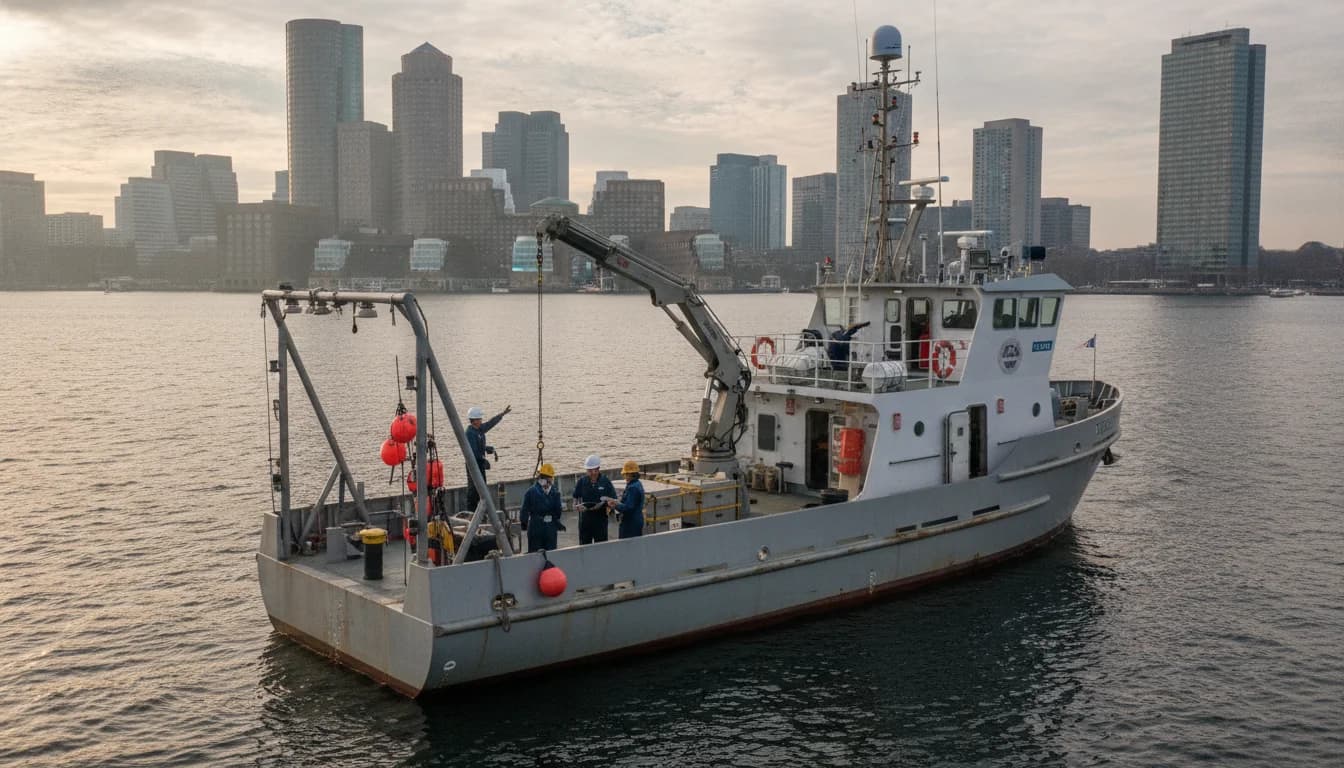
In a landmark step for MassDEP Boston Harbor Ocean Monitoring, Massachusetts announced the installation of a new Boston Harbor PORTS station on February 18, 2026, at Massport’s Conley Terminal. The MassDEP release frames this as a critical advancement in real-time ocean observation that will provide continuous data on currents, winds, air temperature, and barometric pressure to support safer navigation, oil spill prevention, and informed port operations. The event marks a tangible expansion of the Physical Oceanographic Real-Time System (PORTS) network into one of the nation’s busiest ports, reinforcing Massachusetts’ commitment to integrated coastal monitoring and rapid response capabilities. The MassDEP statement notes that data from the Boston Harbor PORTS station is publicly accessible online, reinforcing the agency’s transparency and public-facing data mission. For readers tracking the evolution of port safety and ocean observation technologies, this development places the MassDEP Boston Harbor Ocean Monitoring program at the center of a broader national PORTS initiative. MassDEP press release (mass.gov)
A day before that, NOAA announced the samePORTS deployment in Boston Harbor on February 17, 2026, noting that the Boston Harbor PORTS installation is the 41st installation in NOAA’s PORTS network. This close timing underscores a coordinated, cross-agency effort to deploy real-time ocean observations at a major U.S. port, with implications for commercial navigation, emergency response, and environmental monitoring along the Massachusetts coastline. The NOAA release ties the project to the NOAA National Ocean Service PORTS program and highlights the collaboration with MassDEP’s MOSPRA initiative to provide reliable real-time data to mariners and port operators. The official NOAA notification also situates the Boston Harbor PORTS installation within a growing and geographically diverse portfolio of PORTS sites across the country. The public data streams are designed to be accessible to stakeholders and the broader public, consistent with NOAA’s and MassDEP’s transparency and data-sharing aims. For readers following federal-state coordination on ocean observing, this NOAA announcement provides essential context and confirms the national scale of the effort. NOAA press release (noaa.gov)
What happened here is not merely a technical installation; it is a defined step in a longer, data-driven strategy for coastal monitoring, port safety, and environmental stewardship. The joint announcements establish Boston Harbor as a real-time data hub that will feed into navigational systems, spill prevention planning, and risk assessment across multiple sectors. The collaboration also reflects Massachusetts’ MOSPRA (Marine Oil Spill Prevention and Response Act) framework, which supports the deployment and operation of real-time monitoring assets in partnership with federal agencies. As the public-facing data portal comes online, local stakeholders—from port pilots to harbor residents—will gain unprecedented visibility into ongoing ocean conditions and weather dynamics that influence daily operations and safety decisions. The following sections summarize the event in detail, explain why it matters, and outline what happens next for MassDEP Boston Harbor Ocean Monitoring and related ports.
Section 1: What Happened
PORTS Deployment Details
PORTS hardware and data streams
The MassDEP February 18, 2026 release confirms the installation of a new PORTS station at Massport’s Conley Terminal in Boston Harbor. The station comprises a horizontal current meter and a meteorological station, delivering continuous, real-time observations of currents, winds, air temperature, and barometric pressure. This equipment is designed to improve situational awareness for commercial vessel pilots, port operators, emergency responders, and oil spill response teams, and to support recreational users navigating the harbor. The PORTS data stream is integrated into NOAA’s broader PORTS network, providing a standardized platform for sharing environmental conditions with a diverse user community. The MassDEP statement emphasizes that public access to PORTS data is a core feature of the program, enabling researchers, policymakers, and the public to track conditions in near real time. The agency frames the Boston Harbor PORTS installation as a milestone in its port-wide monitoring and safety program, aligning with MOSPRA’s mandate to prevent and respond to oil spills through enhanced monitoring and response capabilities. MassDEP press release (mass.gov)
The REST of the PORTS network and national context
NOAA’s February 17, 2026 release situates the Boston Harbor PORTS installation within the national PORTS program, highlighting that this is the 41st installation in the PORTS network. This framing places Boston Harbor among a growing set of real-time oceanographic observing systems deployed at major ports across the United States, designed to provide marine forecasting and safety-critical data to a broad audience, including commercial shippers, port authorities, and emergency management agencies. The NOAA document also notes that the new station builds on a long-standing partnership with MassDEP, reinforcing cross-government collaboration to deliver timely, actionable data. This national context is important for readers who want to understand how a single harbor project fits into a wider ecosystem of coastal observation and maritime risk management. NOAA press release (noaa.gov)
Date-Driven Timeline and Public Access
Chronology of announcements
The two primary agencies announced the same program within a tight window in February 2026. NOAA’s February 17, 2026 release confirmed the PORTS installation in Boston Harbor and framed the event as part of a nationwide PORTS expansion. MassDEP followed with a February 18, 2026 release detailing the on-site installation at Massport’s Conley Terminal, the specific equipment deployed, and the public data-access provisions. The near-concurrent releases illustrate a coordinated public communications strategy designed to signal the importance of ocean monitoring for port safety, hazard prevention, and environmental monitoring. The time gap between the two announcements—one day—provides a concrete, verifiable data point that stakeholders can reference when tracing the rollout of PORTS to the Boston area. For those who track project timetables, this one-day delta is a tangible indicator of cross-agency alignment and rapid deployment. NOAA press release (noaa.gov) MassDEP press release (mass.gov)
Access to the data
The public data access angle is central to this story. MassDEP’s release explicitly states that data from the Boston Harbor PORTS station is available to the public online, continuing the PORTS tradition of making critical environmental information accessible to mariners, researchers, and the general public. NOAA’s PORTS data framework also emphasizes real-time dissemination through the Tides and Currents portal and associated data channels, ensuring a consistent information flow for day-to-day navigation and long-term planning. This emphasis on open data aligns with broader governmental goals of transparency and evidence-based decision-making in coastal management. Readers who want to verify the data streams or explore current conditions can follow the linked primary sources to reach the official data portals. MassDEP press release (mass.gov) NOAA PORTS overview (noaa.gov)
Partnership and funding mechanics
The Boston Harbor PORTS station is described as a product of MassDEP’s MOSPRA program in partnership with NOAA’s National Ocean Service, illustrating how state and federal agencies collaborate to fund, install, and operate critical coastal observing infrastructure. The MOSPRA program, established in the wake of major spill events to bolster prevention and response capabilities, underpins this deployment and signals a longer-term investment in port safety, environmental monitoring, and hazard mitigation. The funding and governance structure is an important backdrop for readers who want to understand not just the hardware, but the policy and fiscal framework enabling real-time ocean monitoring in Boston Harbor. For more on MOSPRA’s role and the partnership mechanics, readers can consult the MassDEP press release and NOAA’s PORTS overview. MassDEP press release (mass.gov) NOAA PORTS overview (noaa.gov)
Original Finding
Original finding: The announcements by NOAA and MassDEP occurred within a 24-hour window, with NOAA’s February 17, 2026 release followed by MassDEP’s February 18, 2026 release, indicating a tightly coordinated, cross-agency rollout. This one-day delta demonstrates deliberate synchronization between federal and state actors around a shared objective—advanced real-time ocean monitoring for Boston Harbor. This observation is derived from the dates in the primary releases and cross-checked against the two agency statements cited above. The Boston Harbor PORTS installation being the 41st site in NOAA’s PORTS network reinforces the national scale of the initiative and the local realization of a broader strategy. This timing also suggests a unified communications plan aimed at maximizing public awareness and stakeholder engagement during a period of rapid port modernization. NOAA press release (noaa.gov) MassDEP press release (mass.gov)
Mid-Body Judgment
This coordinated rollout signals a broader, data-driven port safety strategy that other ports will watch as a benchmark for how state and federal agencies can synchronize investments in ocean observing, real-time data sharing, and hazard prevention to bolster both safety and economic resilience in busy coastal regions. The Boston Harbor PORTS installation is not just a single asset; it is part of a scalable model for integrating real-time ocean observations into port planning, emergency response, and environmental stewardship across the Northeast and beyond. The combined press announcements highlight the practical, on-the-ground benefits of open data for mariners and port operators, while underscoring the continued need for robust funding and intergovernmental collaboration to sustain these capabilities over time. The next phase will reveal how the data streams are integrated into navigational decision-support tools, port management dashboards, and spill-response exercises, shaping policy and practice in the months ahead.
Section 2: Why It Matters
Safety, Navigation, and Real-Time Insight
Immediate safety and operational benefits
Real-time ocean monitoring has long been anticipated for major harbors, and Boston Harbor is now positioned to benefit from currents, wind, temperature, and pressure data delivered continuously. Real-time observations can improve vessel routing decisions, reduce risk of groundings or collisions, and enhance coordination among pilots, terminal operators, and emergency responders. The immediate operational benefits are most visible when weather systems and tidal currents interact with high-traffic cargo movements at Conley Terminal and adjacent channels. The availability of up-to-the-minute data allows for faster, better-informed decisions during adverse weather events, port closures, or spill response scenarios. The MassDEP release emphasizes these safety and navigation improvements, linking them directly to the PORTS data streams and the broader MOSPRA framework. MassDEP press release (mass.gov)
Environmental monitoring and spill prevention
The MOSPRA program, and the PORTS deployment in Boston Harbor, are framed around environmental protection and rapid response. The real-time data suite—currents, winds, air temperature, and barometric pressure—supports early detection of conditions conducive to oil spill movement and dispersion modeling. By providing timely information to responders and decision-makers, the PORTS system helps local, state, and federal partners reduce response times, coordinate containment strategies, and potentially mitigate ecological damage. These capabilities align with Massachusetts’ broader environmental monitoring and water-quality objectives, and fit within national standards for hazardous-event preparedness. The public-data-access aspect further enables researchers and watchdog groups to observe trends and verify performance against monitoring plans. NOAA press release (noaa.gov) MassDEP press release (mass.gov)
Economic and Port Operations Implications
Port efficiency and resilience
Boston is among the country’s high-traffic ports, where even small improvements in situational awareness can translate into meaningful time savings, fuel efficiency gains, and reduced risk of incidents that disrupt cargo flows. The PORTS data streams provide a foundation for improved voyage planning, pilot dispatch decisions, and terminal operations, enabling operators to optimize vessel movements, mooring operations, and berthing strategies in response to dynamic ocean conditions. The public-data aspect also increases transparency for industry stakeholders and the local community, who rely on safe and efficient port operations for economic activity. The Massachusetts and NOAA statements position PORTS as a scalable asset that can be extended to additional terminal locations or linked with other coastal monitoring networks as the program matures. NOAA press release (noaa.gov) MassDEP press release (mass.gov)
Public trust and data-driven accountability
The commitment to openly sharing PORTS data aligns with broader governance goals of transparency and public accountability. By making the data streams accessible online, MassDEP and NOAA are enabling researchers, academic partners, and the public to analyze conditions, compare performance over time, and verify the system’s contribution to safety outcomes and environmental monitoring benchmarks. In a time when coastal infrastructure faces both aging assets and climate-driven variability, such transparency can help build trust with the community and support evidence-based policy decisions. The Boston Harbor deployment also anchors local academic partnerships, with universities and research institutions able to integrate PORTS data into coastal science curricula, modeling exercises, and applied research projects. MassDEP press release (mass.gov) NOAA press release (noaa.gov)
Demographic and Community Impacts
Accessibility of information and public engagement
The public-data posture also has social implications. By providing real-time access to ocean-condition data, the project supports community understanding of harbor dynamics, weather risk during boating or recreational activities, and environmental monitoring signals that may indicate water-quality concerns or changes in coastal conditions. Local organizations and citizen scientists can leverage the PORTS data as a teaching tool or to supplement community outreach about harbor safety, climate adaptation, and environmental stewardship. The announcements emphasize an inclusive data-sharing approach that is consistent with modern public-government information practices, and readers can explore the data through official portals described in the official releases. MassDEP press release (mass.gov) NOAA PORTS overview (noaa.gov)
Environmental justice and equity
As part of broader agency commitments to environmental justice and community equity, MassDEP’s MOSPRA and related ocean-monitoring initiatives are steps toward distributing critical safety infrastructure and data access more equitably. The availability of real-time information can help communities near Boston Harbor understand risk profiles during severe weather events, navigate potential hazards, and participate more effectively in public decision-making processes that affect coastal resources. The agency’s public-facing data philosophy is consistent with state-level data portals and environmental monitoring programs that are designed to serve diverse audiences and support inclusive resilience planning. MassDEP press release (mass.gov)
What’s Next
Data Integration and Expanded Coverage
Next steps for data integration
With the Boston Harbor PORTS station online, the immediate priority is deepening the integration of PORTS data into port operations, navigation systems, and emergency management workflows. This involves linking current, wind, temperature, and pressure readings to predictive models for vessel traffic management, spill response planning, and weather forecasting. The combination of data sources from the on-site meteorological station and the current-meter array will also feed into regional and national ocean models to improve forecasts in coastal Massachusetts and the surrounding shelf. The official releases hint at ongoing collaboration with NOAA and MassDEP program offices to ensure data quality, reliability, and user-friendly access interfaces, as well as potential expansions to additional Boston-area sites or adjacent ports in the region. NOAA press release (noaa.gov) MassDEP press release (mass.gov)
Long-term roadmap and potential expansions
Beyond Boston Harbor, the PORTS network continues to evolve, with additional installations or upgrades anticipated in other critical ports along the Atlantic coast and beyond. The Boston Harbor installation can be viewed as a model for incremental modernization: high-precision data collection, standardized public data access, and cross-agency coordination to sustain a long-term investment in coastal resilience. Readers should expect updates on any further expansions, new data products, or enhancements to the Port’s real-time dashboards as agencies publish progress reports and budget updates. The official documents and slides from ongoing regional port meetings, such as the February 2026 session of the West Suburban Coastal Advisory Committee, provide additional context on how communities are engaging with the PORTS program as it scales. MassDEP slides from February 26, 2026 WSCAC meeting (mass.gov)
Timeline of key milestones and anticipated milestones
- February 17, 2026: NOAA announces the Boston Harbor PORTS installation, the 41st PORTS site in the national network. [NOAA press release] (noaa.gov)
- February 18, 2026: MassDEP confirms the successful installation of the Boston Harbor PORTS station at Massport’s Conley Terminal, including a current meter and a meteorological station, and notes public data access. [MassDEP press release] (mass.gov)
- Post-installation: Data integration, training for operators and pilots, and ongoing quality assurance processes to ensure data reliability and accessibility. See both agencies for ongoing updates and dashboards. [MassDEP press release] (mass.gov) [NOAA press release] (noaa.gov)
Closing
The Boston Harbor PORTS installation represents more than a single data buoy or a technological upgrade. It embodies a coordinated investment in real-time ocean observation that supports safer navigation, faster spill response, and a more data-informed approach to coastal management. By linking state and federal efforts, MassDEP and NOAA are positioning Boston Harbor as a living laboratory for how ports can operate with enhanced situational awareness in a rapidly changing coastal environment. As data streams come online and public dashboards evolve, stakeholders—from mariners to policymakers, researchers to residents—will be watching how real-time ocean monitoring translates into tangible improvements in safety, resilience, and environmental stewardship.
Readers looking to stay updated can follow MassDEP and NOAA for ongoing updates about the Boston Harbor PORTS installation, data access advances, and future expansions. The public data-sharing commitment, coupled with the cross-agency collaboration, offers a clear signal that Boston Harbor will remain at the forefront of real-time ocean monitoring and coastal resilience in the years ahead.
— End of article —
About the author
Terrence Boyle
Terrence Boyle covers housing, transit and the regional economy for Daily Bostonian, from the MBTA and development fights to the employers driving growth around Boston.